


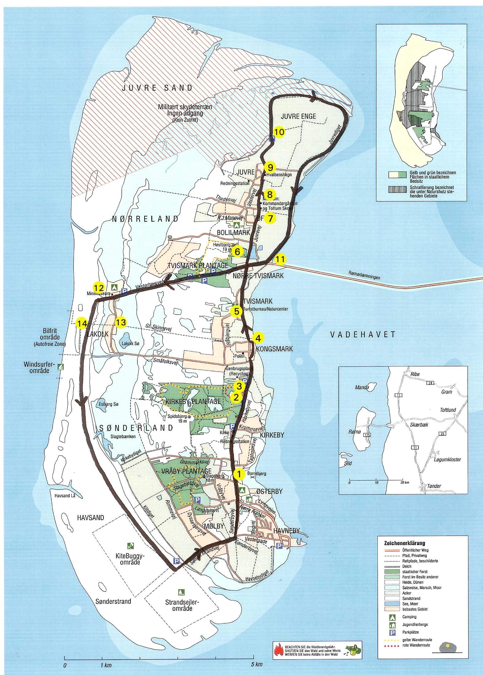
The tour begins at the tourist office. From Tvismark, the journey west to Lakolk goes along the Rail Road through a protected dune area with many different species of animal and plant. Just before Lakolk, look south over Lake Lakolk, which has a very rich bird life. There is no access to the reed woodland surrounding the lake. From Lakolk, continue on the sandy beach either all the way out by the water (the dotted line on the map) or inside along the protected sand marshlands. At Sønderland, continue to the east through the cultivated sand marshlands and northwards through sand marshes and clawed and on through Kirkeby Plantation and Kongsmark.
about 17 km - about 5 hours
The tour begins at Rømø church. From here you walk through Vesterhede and Vråby Plantation with Stagebjerg from where there is an excellent view. The tour continues along the road through the cultivated sand marshlands, through the dunes to Havsand and further south along the dunes. At the descent can either be continued up on the die to Havneby or at low tide south of the marsh area on the first part of the line. From Havneby, continue north past the ancient monument Borrebjerg and on through the cottage area back to the church.
about 14 km - about 4 hours
The tour begins at one of the rest areas and is marked in yellow on low posts. The tour goes through part of Tvismark Plantation and the adjacent clich1st area. From the 20 m high Høstbjerg there is a fine view of Rømø.
about 3 km - about 1 hour
To be booked at reception, only limited number
1: Borrebjerg: At the start of the tour, just after the exit, you can see Borrebjerg over the meadows on the right. 100 years ago you could see the floor plan of a large castle. Unfortunately, however, the castle hill has been heavily excavated, as clay was previously collected from here for house building m.m.
2: Kirkeby Rescue Station: Creates in 1852. The island was not in Danish hands at that time and was therefore set up by the "German shipwrecked company". In 1929, the Danish Rescue Service took over the island's rescue stations. The rescue station was used until 1965, when the lifeboat was moved to the newly opened port of Port. Today, the building is taken over by Rømø volunteer fire fighters.
3: Rømø Church: Open Tuesday - Friday from 8:00 to 16:00. A very cozy church with low ceilings, many beautiful church ships and quite a few hat hooks.
The commanders in Kirkeby: A collection of distinctive headstones over Greenland commanders with descriptions of the captain and his family.
4: The old ferry rental and the medical residence in Kongsmark: The ferry berth is located at the construction site where the former Hotel Rømø was located. At low tide you can still see some of the pills. Here you can also see the medical residence in Kongsmark right next to the construction site.
The ferry service is believed to be as far back as the 1700s. Its last ferry "Rømø" is today taken over by the Rømø Scouts, and can be seen in Havneby. The ferry sailed in the last period from 1916 to 1948 to Ballum sluice. At low tide, horse-drawn carriages were used to drive passengers to the ferry. At the port of Kongsmark, more than 30 sailing ships have been registered at the port of Kongsmark.
5: Tønnisgård/Tourist Office: Tønnisgård is a nature centre that has a new and exciting way about Rømø's formation, the movement of tides, the dike, whaling and much more.
6: Harvest mountain: If you have time and effort, you can climb Rømø's highest mountain – a total of 19 metres. Here turn left at the sign with Bolilmark.
7: Denmark's smallest and oldest school, Toftum: The school was used from 1784 to 1874 and sometimes accommodated up to 40 children. The teacher was always an old Commander.
8: National Museum's Kommandørgård in Toftum: Here you can see Kommandørgården from the old days when the commanders were wealthy people who could afford to build big houses. Today, the courtyard is a museum under the National Museum.
9: Gardening of whale jaws, Juvre: A garden ing of whale jaws from 1772.
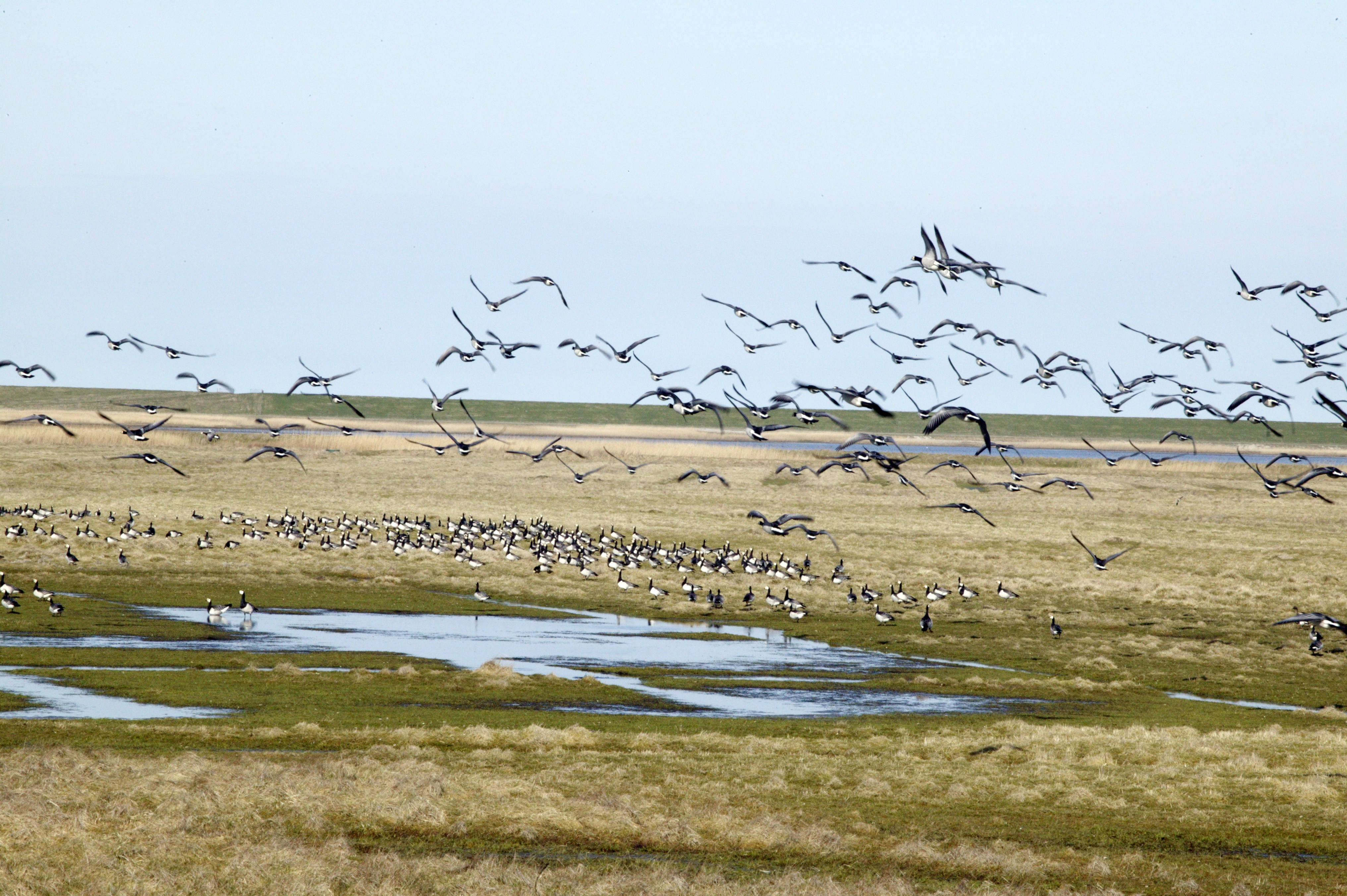
10: Shooting range: On the northern tip of Rømø in Juvre meadows there is a viewing platform made on top of Juvrediget. From here you get a good view of the north-west meadows, which are currently inaccessible to the public, as they are used by the Danish firearm. The sheep have learned over time that if a plane comes, they will move about 20 metres from the target.
11: Dam: Built in the years 1939 - 1948
At the start of the dam you can clearly see the candy farms framed by faskins. But compared to those saw earlier in the route, these are considerably larger. In the candy farms along the dam you can clearly see the traces of the ditching machine's work to gain land. Work was halted a few years ago when it could no longer be economically sound.
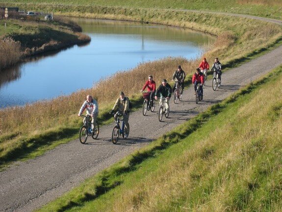
At the dam turn right towards Lakolk. On the way to Lakolk you can see many bunkers – one of these has now been opened to the public. (Contact the Tourist Office if necessary)
12: Rømø Mini Museum: Lakolk shopping square has a small museum that is well worth a visit. Here you can experience how Rømø has emerged, what animals and plant species are here and much more.
13: Small people's road: It is recommended to cycle a little along Småfolksvej in a southerly direction at the traffic lights. About 1 km. after you get to "The Old Railway Station" and "Skinnervejen" just off Hotel Lakolk.
If you want to go home by paved road, you just have to follow the Small People's Road, but if you want to drive along the beach home you have to go back to the traffic lights and then down to the sea. We recommend the beach road but it is also more strenuous.
When cycling on the beach you have to follow the di order, as the sand here is mostly downed.
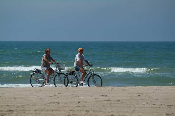
14: Lakolk Beach: Here you can see the large sandy surface, which varies in width from about 1 km. at Lakolk to the 4 km. wide sea sand at Sønderstrand on the South Island. During heavy westerly storms, the sand surface may have turned into a large shiading sea. This happens about 2 –3 times a year.
When cycling you can see some dune formations on your right hand, all the way out by the sea. These are actually formed within the last 20 years. During The West Storm, Rømø receives some sand from Sylt, i.e. Rømø's beach is becoming ever wider. A local saying on the island says; Herring wants to go back to Rømø.
When approaching Sønderstrand you can see the Rømø/Sylt ferry sailing so it looks like it is "running" on the beach.
Good trip home!
Let your child discover the island on the seat of an electric car.
Terms of Business - Aktivities